Turbulence Parameters from Coherent Doppler Lidar
Radial velocity structure functions are processed to estimate the turbulent kinetic energy (TKE) dissipation rate, integral length scale and velocity variance, assuming a theoretical model for isotropic wind fields (Von Karman). Corrections for turbulence measurements have been considered to address the complications due to inherent volumetric averaging of radial velocity over each range gate, noise of the lidar data, and the assumptions required to estimate effects of smaller scales of motion on turbulence quantities. (For details please refer Krishnamurthy et al. 2011).
The structure function approach requires the following assumptions to hold: (1) the von K´arm´an turbulence model is applicable, (2) for the azimuthal method, the atmosphere is approximately frozen over the time it takes the lidar beam to scan an arc distance equal to the outer length scale Lo, and, (3) also for the azimuthal method, the radial velocity of the turbulent field can be approximated as a component of a Cartesian velocity. Results for the T-REX study are presented below.
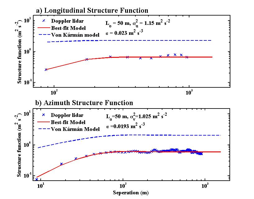
 Figure. (a) Longitudinal structure function and (b) azimuthal structure function versus separation at 2052 PST (0452 UTC) on 19 April 2006. Doppler lidar velocity structure function with error analysis (crosses); structure function estimates from best fit parameters (solid line); structure function derived for point measurements based on lidar retrieval (dashed line).
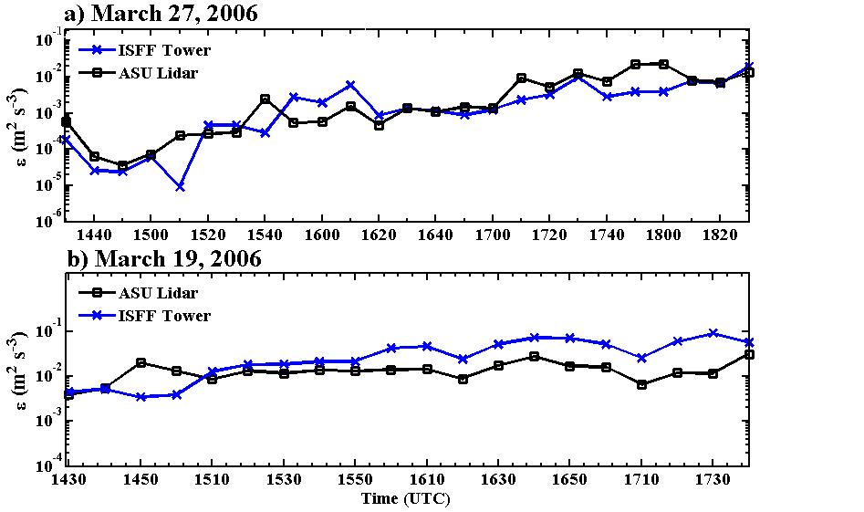
 Figure. Ten minute averaged evolution of dissipation rate (ε) at 30 m on (a) 27 March 2006 (up-valley) and (b) 19 March 2006 (down-valley). Estimates from ASU lidar (solid line with squares), spatial and time averaged; ISFF tower measurements (solid line with crosses), only time averaged.
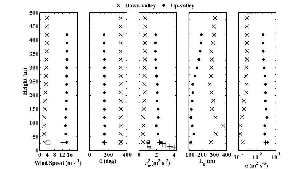
 Figure: Daytime averaged profiles of wind speed, wind direction (θ), variance of transverse velocity fluctuations (σ2), integral length scale (Lo) and energy dissipation rate (ε) at 2102 UTC (1302 LT). Daytime up-valley (solid circles) on 27 March 2006 and daytime down-valley (cross) on 19 March 2006. Estimates from tower measurements (plus and squares) for the same time period (5 m intervals). Due to insufficient samples of tower measurements on 19 March 2006, dissipation estimates are not shown.
Remote Sensing for Wind Energy
 Figure. (a) Longitudinal structure function and (b) azimuthal structure function versus separation at 2052 PST (0452 UTC) on 19 April 2006. Doppler lidar velocity structure function with error analysis (crosses); structure function estimates from best fit parameters (solid line); structure function derived for point measurements based on lidar retrieval (dashed line).
 Figure. Ten minute averaged evolution of dissipation rate (ε) at 30 m on (a) 27 March 2006 (up-valley) and (b) 19 March 2006 (down-valley). Estimates from ASU lidar (solid line with squares), spatial and time averaged; ISFF tower measurements (solid line with crosses), only time averaged.
